
Page 31 - John Barber's Oakham Castle and its archaeology
P. 31
Robbed wall 9 and robbed wall 17
denote the outer walls of the Castle to
north and south but may not have been
exactly in line with the walls of the north
and south walls of the aisles of the hall, as
there is evidence in the string course at all
but the north-west corner of the hall
(where the modern cells obscure the issue)
that perhaps the buttery/pantry complex on
the east end, and the solar on the west end,
were set back a foot to fifteen inches.
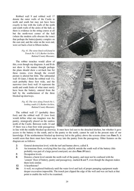
Fig. 41. The stone-lined well found in
Trench No 1 (J L Barber Archive,
Rutland County Museum).
The robber trenches would allow of
this, even though my diagrams A and B do
not show it. On mature thought perhaps
the plans should show a set-back line for
these rooms, even though the overall
picture is altered but little. The substantial
wall 10 (later, I think the robbed wall 11),
each probably three foot wide, and the
narrower (two foot) wall 14 represent the
north and south limits of what must surely
have been the buttery, entered from the
hall by the southernmost of the three
blocked up doorways.
Fig. 42. The view along Trench No 1,
looking south (J L Barber Archive,
Rutland County Museum).
The robbed wall 17 (probably three
foot) and the robbed wall 15 (two foot)
would define what one imagines was the
pantry, strategically placed on the sunless
north of the Castle. Between walls 14 and
15 there was a four-foot wide passageway
in line with the middle blocked up doorway. It must have led east to the detached kitchen, but whether it gave
access to the buttery to the south, and to the pantry to the north, cannot be said in the present state of our
knowledge. If the northernmost blocked up doorway led to the gallery above the screens alone (see Para 5), it
would seem that there must have been some way into the pantry from the passageway. Other features on the
diagram are as follows:
2: General destruction level, with the turf and humus above, called 1.
3: An ironstone floor, overlying blue lias clay, called 4, outside the south wall of the buttery (this
probably was part of a large paved courtyard, see also Para 10 later).
5: Occupation levels.
8: Denotes a burnt level outside the north wall of the pantry, and must not be confused with the
‘cement’ floor of buttery, pantry and passageway, marked 6 and 7, even though the diagram makes
them look similar.
12: A hearthstone?
16: A well, we explored fruitlessly until the water level and lack of proper pumping equipment made
deeper excavation impossible. The trench just clipped the edge of the well and was cut back at that
point to enable the well to be examined.
29