
Researching Rutland
Copyright © Rutland Local History and Record Society. - All rights reserved
Registered Charity No 700273


Search
Book Review
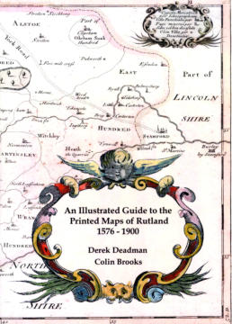
An Illustrated Guide to the Printed Maps of Rutland 1576-1900
Derek Deadman and Colin Brooks
The Landseer Press 2012 - ISBN 9788700008366 - 321pp £30
This book is a listing of the printed maps of Rutland from 1576 to 1900, strip maps from 1675
to 1826, and hunting maps from 1830 to 1900. It is intended as a guide to those collecting or
wishing to identify Rutland maps. For each map there is an entry giving the date, the size of
the map, the scale, the name of the mapmaker, the title, and details of the publication
history. On the facing page is an excellent photograph of the map. There are 194 illustrations
in colour and black and white. Obviously a great deal of research has gone into the
production of this book, as can be seen from the interesting Introduction by the authors.
As well as treating this volume as a listing one is tempted also to use it for map reading in
connection with local history studies. In cases where a map is large, and therefore the
reproduction has had to be much reduced to fit the page, reading of the map becomes
difficult and in some cases it is not possible to use such maps to identify place names and
topographical features. However, the quality of the reproduction is so good that the majority
of the illustrations are readable. A few, particularly the older maps, contain engravings of
stately homes and street maps of the major towns.
As Mike Goldmark says in his Preface, this book will no doubt inform and inspire a new
generation of collectors of county maps. It will also be valuable to local historians who wish
to trace changes in Rutland during the period covered by the guide.
Peter Tomalin


Researching Rutland
© Rutland Local History and Record Society
Registered Charity No 700273

Book Review
An Illustrated Guide to the Printed Maps of Rutland 1576-1900
Derek Deadman and Colin Brooks
The Landseer Press 2012 - ISBN 9788700008366 - 321pp £30
This book is a listing of the printed maps of Rutland from 1576 to 1900,
strip maps from 1675 to 1826, and hunting maps from 1830 to 1900. It is
intended as a guide to those collecting or wishing to identify Rutland
maps. For each map there is an entry giving the date, the size of the
map, the scale, the name of the mapmaker, the title, and details of the
publication history. On the facing page is an excellent photograph of the
map. There are 194 illustrations in colour and black and white.
Obviously a great deal of research has gone into the production of this
book, as can be seen from the interesting Introduction by the authors.
As well as treating this volume as a listing one is tempted also to use it
for map reading in connection with local history studies. In cases where
a map is large, and therefore the reproduction has had to be much
reduced to fit the page, reading of the map becomes difficult and in
some cases it is not possible to use such maps to identify place names
and topographical features. However, the quality of the reproduction is
so good that the majority of the illustrations are readable. A few,
particularly the older maps, contain engravings of stately homes and
street maps of the major towns.
As Mike Goldmark says in his Preface, this book will no doubt inform and
inspire a new generation of collectors of county maps. It will also be
valuable to local historians who wish to trace changes in Rutland during
the period covered by the guide.
Peter Tomalin